Thousands of customers are still in the dark on Thursday after high winds caused power outages in parts of Western Washington.
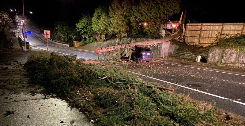
The Eastside was hit particularly hard. Transformers blew out in Bellevue, and trees fell on vehicles in Redmond on Wednesday. One tree landed on top of a car, shutting down all lanes of Northeast 116th Street for hours while crews removed the tree. The driver was not hurt.
A tree also hit a UPS truck in Redmond, going right through its roof. Luckily, the driver was not inside the truck when the tree fell.
0 of 16


In West Seattle, a tree came crashing down on 35th Avenue Southwest, blocking all lanes and damaging power lines and poles.
“We’re just jumping from outage to outage,” Ron, a crew member at Puget Sound Energy, said. “Lot of limbs, a lot of limbs coming on the line, and there’s about 25 of us guys that are first response that are going around knocking off the limbs, and if it’s something more involved, we turn it into a crew.”
A viewer in North Bend sent KIRO 7 a video showing another transformer explosion and said it caused a small brush fire, but crews were able to knock the fire out quickly.
EF&R is responding to power lines down around the service area due to wind. Stay clear of down power lines (at least 150ft back) and report any dangerous situations to 911 pic.twitter.com/TP7C3qElVT
— Eastside Fire & Rescue (@EastsideFire) January 5, 2023
Power was knocked out for thousands in Kirkland and caused traffic delays.
“I mean, the lines are crazy, and there it’s packed both lines ... It was just packed, like three or four lights were out and then just slowly going one by one,” Marcel, who lives there, said.
Thousands were left in the dark, but Marcel said he was prepared.
“We have a generator, yeah, that we can plug in and will go, but yeah, it’s not going to run the whole house, just the basic stuff, you know, lights and probably not heat,” he said.
Crews are working as quickly as they can to restore power.
“The wind is still blowing, so hopefully, we get it all back on restored throughout the night, and everyone’s got power in the morning,” Ron said.
Forecast:
Wind Advisories are still in effect for the Cascade foothills until 10 a.m. where gusts could be in the 40 mph range.
There is also a Wind Advisory for the Coast until Friday because the wind direction will become southerly and be pretty strong at the coast later Thursday and into tonight.
The east wind will continue for most of the day, but it will gradually calm down as the day goes on, but still, it will be windy.
We only have a few pockets of showers this morning, but showers should increase late this afternoon and evening. Temps will be warm today in the low 50s.
On Friday, another round of rainy and breezy weather will move in, but the wind will not be as strong.
The longer-range outlook is for storm after storm to parade by our coastline through the weekend and into next week, spinning breezy fronts with wind and rain into Western Washington from time to time. Any breaks look quite brief and could occur around Sunday and by the middle of next week.
Rainfall amounts will total 1 to 3 inches in the lowlands through the period. While far less than they’ll see in California, we could still have a greater chance of shallow landslides as we go through the weekend and into next week.
Looking ahead toward the middle of January, the Climate Prediction Center has Western Washington in a greater-than-average chance of milder, yet wet weather — basically a continuation of how the next seven days look. Rainy, but not unusually cold, though a good chance of continued snow accumulation, especially on the higher mountain peaks and ski areas.
©2023 Cox Media Group