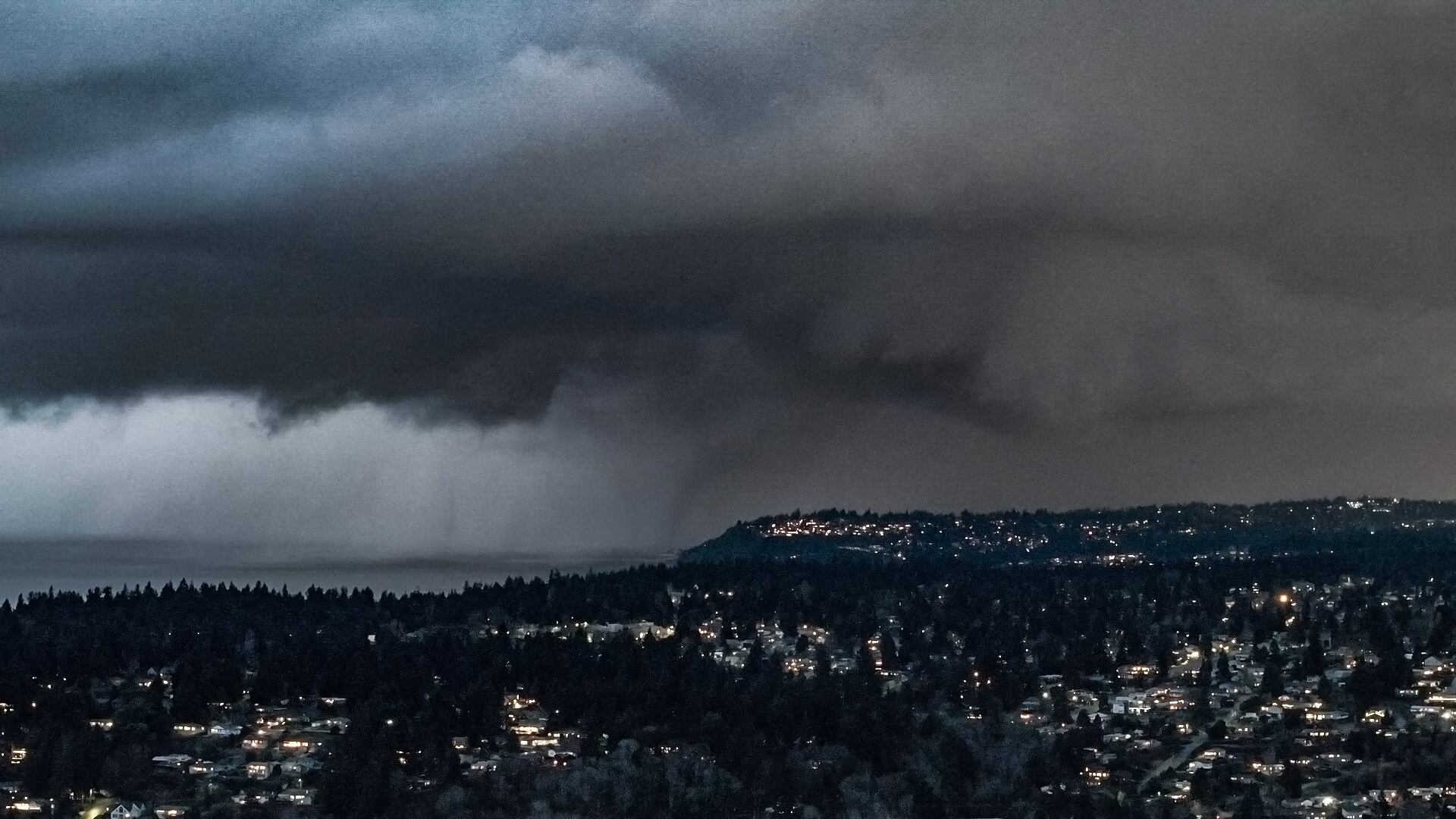
PUGET SOUND, Wash. — As the strong weather disturbance began to move ashore the Pacific Ocean early Wednesday evening, a very rare occurrence appears to have briefly happened over Puget Sound off South King County: twin waterspouts!
The image was captured by Michael Snyder of Pacific NW Weather Watch on YouTube and was later enhanced to bring out the details of the low-light image captured after sunset. KIRO 7 Chief Meteorologist Morgan Palmer agrees it appears there’s a larger funnel cloud or potential waterspout (if in contact with the water) in the center of the image. Just to its left, there appears to be a very thin, ragged “rope” waterspout extending to the water’s surface.
This cell was strong enough to produce updrafts capable of producing waterspouts, and it even fired off a lightning strike near Vashon Island near the time of the image. The storm then moved northeast and dumped copious amounts of small hail over West Seattle before forming a northward-moving line of snow that impacted Snohomish County later in the Wednesday evening commute.
Palmer also says there was veering — or twisting — of winds at the lowest levels of the atmosphere at the time of the event, which aided in the development of the apparent waterspouts. Doppler radar also detected weak rotation, which is common with waterspouts. There was no other sighting reported of the phenomena and no warnings were issued.
This is apparently the second episode of waterspouts during this wintry cold blast in Western Washington. A waterspout was photographed off the western coast of Whatcom County on Sunday when a thunderstorm developed off Birch Bay and west of Blaine.
©2025 Cox Media Group