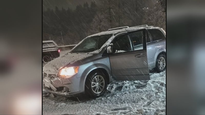
WESTERN WASHINGTON — Snow fell across parts of Western Washington overnight into Thursday morning, trapping drivers, delaying schools and causing power outages for thousands of customers.
Parts of Kitsap County and areas south and west of Puget Sound saw the heaviest snow, but Mother Nature also dropped snowflakes in Seattle, coating yards and even some roads.
Dozens of school districts were either delayed or closed.
Several inches of heavy snow fell overnight, which proved to be treacherous for some drivers, especially in one area.
>>KIRO 7 PinPoint 7-Day Forecast
About 50 cars were stuck in a ditch because of the conditions in the southbound lanes, just south of Olympia at the Highway 101 interchange.
At that time, drivers were only able to use two lanes.
The area has since reopened, but a few drivers continued to spin out on I-5 in Olympia during morning traffic.
Across Western Washington, about 49,000 customers were without power Thursday morning, with the majority in Kitsap, Pierce and Thurston counties. That number has since improved, but thousands are still in the dark. Get the latest outage numbers at this link.
In Kitsap County, trees heavy with slushy snow fell and brought down power lines, according to Washington State Patrol Trooper Katherine Weatherwax.
What a difference a few hours can make. Here is a before and after of our crews working at US 101 and I-5 in #Olympia earlier this morning.
— WSDOT Tacoma (@wsdot_tacoma) February 15, 2024
There's still a lot of slush out there!
✅ Take it slow
✅ Drive for conditions
✅ Check the real-time travel map https://t.co/HUGa1WTJfY pic.twitter.com/2T3AcD4R2x
Forecast from KIRO 7 Meteorologist Nick Allard
We have a mix of everything this morning with snow/wet snow and rain showers all over. Just like we forecasted, the snow has been heaviest west and south of Puget Sound. We still have Winter Weather Advisories for Tacoma south and from the eastern Kitsap Peninsula south until later this morning.
Snow/wet snow and rain showers this Thursday morning. We're covering where there will be more accumulating snow and what conditions will be like for you when you head out this morning! Watch KIRO7 all morning. #NickKnows #wawx pic.twitter.com/o3rUy75py9
— Nick Allard (@NickAllardKIRO7) February 15, 2024
There is a Winter Storm Warning for the Hood Canal area where the snow has really been coming down. For those areas I expect another couple of inches will fall through the morning and into the early afternoon. East wind is really helping to cause upslope snow showers around the Olympics and temps are coldest here.
The rest of the area will see scattered rain/snow and wet snow showers that mainly should not accumulate on main roads, but could produce a slushy 1/2-1″ on grassy surfaces, roofs and possibly some side roads. Most areas are above freezing and east wind is still helping to “eat” some of the snow and moisture falling. I think a lot of you will have slush on the road with snow/wet snow falling that shouldn’t accumulate.
>>Scroll down to continue reading
The wind has been really strong overnight around the Fraser River and especially in the Cascade foothills. There is still a Wind Advisory for the foothills until 7 a.m. Gusts have been in the 40 to 50 mph range. The wind will ease a bit after 7 a.m., but it will still be gusty to breezy.
Showers will decrease a lot later this morning with much drier weather and scattered mostly rain showers along with highs in the low to mid-40s. We’ve had a lot of snow in the mountains around Crystal and especially Paradise, with more this morning and then snow showers this afternoon.
Looking ahead
There will be a little moisture around Friday morning that will decrease with increasing sunbreaks and highs getting back to around 50°. This weekend looks pretty calm with some light showers and highs in the low-50s.
©2024 Cox Media Group


